Anthony Veltri Explains why Federation Cannot Replace Stewardship
A plain-language companion to: Veltri, A. (2026). “Federation Cannot Replace Stewardship: Governing the Calibration Chain in Continental-Scale Observation Networks.” Bulletin of the American Meteorological Society, Early Online Release. DOI: 10.1175/BAMS-D-26-0091.1
My article, Federation Cannot Replace Stewardship: Governing the Calibration Chain in Continental-Scale Observation Networks, was published in the Bulletin of the American Meteorological Society. It was written for readers who generally understand Earth observation, meteorology, or scientific data systems. That audience may already be familiar with terms such as calibration, traceability, uncertainty, and validation.
But radiometry, the measurement of light and other electromagnetic radiation, is not really the subject. The subject is a governance problem that appears anywhere people depend on measurements gathered by other people, instruments, institutions, or nations. Federation, as I use the term here, means connecting independently governed systems without pretending that one central authority owns them all.
The examples in the article come from satellites, ocean instruments, disaster mapping, ecological change, power generation, ice-core archives, and local weather observation. They may appear unrelated at first. Each one reveals a different part of the same underlying problem:
A data system remains trustworthy only while someone maintains its connection to physical reality, understands its limits, and has the authority to act when that connection becomes uncertain.
This companion explains what each example is doing in the argument and why it matters beyond the specialist field in which it occurred.
The intersection is a peculiar one, and perhaps peculiar to my own career. Almost everyone will be a lay reader somewhere in this piece. A radiometry specialist may not know RF propagation or federated information systems. Someone who has managed a national program may not know what a blackbody standard does. A power engineer may not know why ground truth matters in remote sensing. I have therefore kept the technical terms where they carry real meaning, but added a short handhold when each field enters the discussion.
A note on how to read this. You do not need to start at the beginning. If you already know remote sensing but got lost in the propagation discussion, skip ahead to part 6. If you came from the RF side, part 2 is where the two disciplines meet. If you manage systems rather than instruments, parts 6 through 8 are the ones written closest to your world. The list below tells you what is where.
- The failed calibration mechanism aboard Meteosat Third Generation – stewardship working under pressure when hardware fails.
- AERONET-OC and the SIRCUS-FASCAL discrepancy – why agreement between two competent labs is not the same as independence.
- Fiducial Reference Measurements and the limit of technical standards – measurement quality is not the same question as fitness for a decision.
- DHS aerial imagery and “situational awareness only” – the same image can be excellent for one question and unacceptable for another.
- Three ways an observation can become inadequate – ghost forests, hemlock decline, and Hurricane Katrina.
- GII/OneView and what federation actually accomplishes – federation solves coordination, not truth.
- Mike E. and the Hoover Dam alternator – what named stewardship actually looks like.
- The Ocean Observatories Initiative and the missing last step – documentation cannot substitute for funded labor.
- The Canadian Ice Core Archive and option value – why a monitoring system must itself be checked.
- The cooperative weather observer and person-to-person transfer – stewardship that outlives the steward.
- Landsat and the need for ground truth – the physical anchor point is not overhead, it is the product.
Why this article pulls so much together for me
My initial graduate work was in remote sensing. I began close to the scientific problem itself: how observations made from above relate to what is actually present on the ground, and why a remote measurement still needs a verified physical reference.
I also spent part of my career modeling radiofrequency propagation for wireless work. That forced me to separate several things that arrive at the receiver as one number. What did the terrain and built environment do to the signal? What part of the variation came from multipath or shadowing? What did the antenna, receiver, calibration, drive-test route, and sampling method contribute? A field-strength reading may look like a fact. Before it becomes useful, somebody has to understand which layer produced it.
That RF work was another version of the same problem I had encountered in remote sensing. Am I seeing a change in the world, a limit in the instrument, an artifact of the method, or some combination of the three?
I later applied geographic information systems, or GIS, and remote sensing at the scale of national programs. At the Department of Homeland Security, iCAV and the later GII/OneView environment were systems of national significance. They connected information, institutions, and users operating at scales far beyond an individual research project.
That work gradually moved me away from the science of a particular radiance comparison or fiducial reference measurement and toward the technical and institutional work required to implement such systems. My questions became less about how one instrument was calibrated and more about how hundreds of organizations could share information, preserve meaning, respect separate authorities, and keep the resulting system operational.
The scientific and implementation sides of that career were never truly separate. They were different views of the same problem. A satellite product still needs a trustworthy relationship to physical reality. A national information architecture must preserve that relationship while the product moves across systems, organizations, and purposes. The farther the information travels from the people who produced it, the easier it becomes for users to inherit the product without inheriting an understanding of its limits.
This article brings those parts of my experience back together. It connects my early work in remote sensing, my later responsibility for federated systems, and an observation that had been forming for at least a decade: large technical systems remain dependable only when responsibility for their critical anchor points is visible, supported, and capable of acting.
Named responsibility is a two-way obligation
The phrase “named ownership” can be misunderstood if it is reduced to putting someone’s name on an asset, dataset, control, or task.
The plaque at Hoover Dam matters because it makes stewardship legible. It tells the institution and the people working around the alternator that a particular person is close enough to its condition to answer for it. But the name alone is not sufficient.
Responsibility must run in both directions.
The named steward owes the institution attention, judgment, candor, and care. The institution owes that person the authority, information, tools, time, resources, and organizational support needed to exercise that judgment. It must also give the steward enough standing to report that something is outside tolerance, delay a decision, request additional verification, or say that a product is not adequate for its proposed use.
An institution can assign responsibility while withholding the capacity to fulfill it. It can put a person’s name on the plaque but deny that person access to the gauge, the maintenance budget, the decision-maker, or the authority to stop the machine. In that situation, the name does not create stewardship. It creates ceremonial accountability and, potentially, a convenient place to assign blame after failure.
Named ownership therefore requires two things at once:
- A person whose responsibility is visible and whose professional judgment is attached to the condition of the system.
- An institution structured to support that person and act on what their judgment reveals.
The same reciprocal obligation applies to calibration scientists, field-site managers, archive curators, principal investigators, control owners, and operational analysts. Someone must be willing to put their name on the condition of the anchor point. The organization must make that name operationally meaningful.
How peer review changed the article
The publication process began in March 2026, but the thought process behind the article had been developing for at least a decade. The initial manuscript was approximately 2,400 words and centered primarily on what I had observed over twenty years: distributed systems repeatedly depend on physical anchor points and named people whose importance becomes visible only when continuity begins to fail.
The peer-review process was exceptional. Reviewer 2, in particular, helped sharpen the argument by pressing it beyond personal observation and into more precise engagement with the scientific and technical structures surrounding calibration, validation, fiducial reference measurements, and decision use.
The manuscript grew to approximately 4,500 words. Those additional words were not padding. They forced the argument to distinguish more carefully among several related ideas: a calibrated measurement, an independently verified calibration chain, a product that is fit for a particular use, and a person with authority to act when those conditions no longer align.
That process produced a stronger scholarly article. It also made the published version more technical than the original essay had been. The specialist detail is necessary because the governance claim must withstand scrutiny from the scientific community whose work it discusses. But that detail can make the connective argument harder to see for readers outside radiometry, meteorology, or Earth observation.
That is why this companion exists. It is not an erratum and it does not retreat from the technical version. It restores a second entry point into the same argument by explaining why each example was chosen, what role it plays, and what a non-specialist should carry forward from it.
1. The failed calibration mechanism aboard Meteosat Third Generation
What happened
The Flexible Combined Imager aboard Meteosat Third Generation Imager 1 suffered a failure in the onboard mechanism used for routine calibration. The satellite was already in orbit. The failed hardware could not simply be repaired or replaced.
EUMETSAT responded by adapting a broader calibration system called MICMICS. Instead of relying exclusively on the failed onboard mechanism, the organization used external reference targets and comparisons with instruments on other satellite missions to restore confidence in the measurements.
An external reference target is something outside the failed onboard device whose behavior is stable or well understood enough to serve as a check. A cross-comparison asks whether another satellite, observing the same or a comparable target, tells a consistent story.
Why I used this example
This is the opening example because it separates equipment reliability from governance reliability.
The hardware failed. The institution responsible for the mission still had the expertise, tools, relationships, and authority needed to determine what the failure meant and construct another defensible path back to trusted measurements.
I did not cite this as an example of failure. I cited it as an example of stewardship working under pressure.
Why it matters
Resilience does not mean that nothing breaks. It means the larger system can recognize a break, evaluate its consequences, and establish another trustworthy path forward.
That requires more than redundancy in equipment. It requires retained expertise, institutional memory, access to independent references, and people empowered to make decisions about data quality.
2. AERONET-OC and the SIRCUS-FASCAL discrepancy
What the study actually found
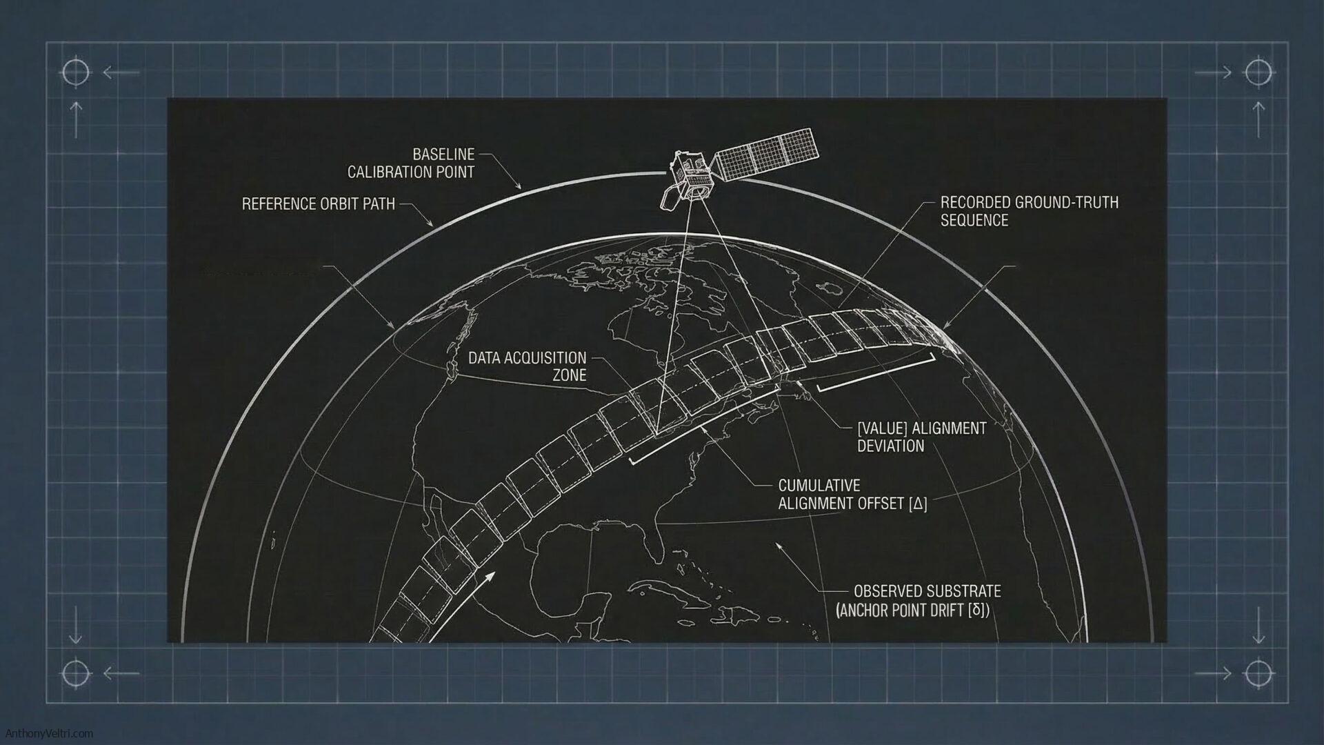
AERONET-OC instruments take measurements above the ocean that are used to check satellite observations of ocean color. That may sound like a narrow technical task. It is not. Ocean-color measurements sit underneath estimates of chlorophyll, water properties, marine ecology, and environmental change. Before anyone can trust those larger conclusions, someone has to establish that the instrument is measuring light accurately.
Radiance is a way of describing how much light arrives from a particular direction. Spectral radiance separates that measurement by wavelength, or, in loose everyday terms, by color. That distinction matters because an instrument can agree with a reference at one wavelength and pull away from it at another.
One instrument, AERONET #080, was routinely calibrated by both NASA’s Goddard Space Flight Center and the European Commission’s Joint Research Centre. Their results agreed within the stated uncertainty. So far, so good.
Then a NIST-supported study brought in another independent comparison. It confirmed the reassuring part: the NASA and European calibrations agreed within their combined uncertainty. But the comparison also turned up a small difference that changed with wavelength. That difference appeared between two laboratory routes used to establish the radiance reference underneath the calibrations.
Those routes were associated with SIRCUS and FASCAL. They were two carefully constructed ways of tying measurements of light back to physical standards:
- SIRCUS used tunable lasers to supply carefully controlled light at selected wavelengths. A calibrated detector anchored the comparison.
- FASCAL used a calibrated light source tied to blackbody temperature standards. In this context, a blackbody is not merely an object painted black. It is an idealized radiator whose light output can be predicted from its temperature. That predictable relationship allows temperature to anchor the radiance scale.
At the risk of oversimplifying it, SIRCUS builds outward from a calibrated detector, while FASCAL builds outward from a calibrated source. Both are legitimate routes to the same kind of reference value.
Metrologists call these physical implementations of a measurement scale realizations. The term sounds more mysterious than it is. A realization is the laboratory procedure that turns an abstract measurement standard into something a working instrument can actually be compared against.
The study did not prove that either route was simply wrong. It found that the two defensible routes did not align perfectly across all wavelengths. The cause of the pattern remained unexplained.
Is this tolerance stacking?
Not in the sense of a custom mechanical assembly where every part falls within its own dimensional tolerance, but the accumulated fit among the parts still causes the complete system to malfunction. Calibration chains do carry multiple sources of uncertainty, and those uncertainties must be accounted for. But the AERONET-OC study did not show several acceptable deviations stacking together until the instrument failed.
There is also a vocabulary difference worth keeping straight. A tolerance is an acceptance boundary: how far a part or result is allowed to vary. Measurement uncertainty describes how confidently we know the value or the difference between values. Saying that two calibration results agree within their combined uncertainty is not the same claim as saying that every part in an assembly falls within its manufacturing tolerance.
The closer analogy from my own background is a datum problem. Imagine two geospatial datasets that line up within their stated accuracy. An independent check then finds that the reference systems beneath them align closely in one part of the map but gradually pull apart as you move across it. Neither dataset suddenly becomes worthless. The pattern does tell you that the relationship between the underlying references needs to be understood.
In the radiance comparison, wavelength takes the place of location on the map. The reference routes were close, and the operational product remained usable, but the difference changed across the spectrum. That is a reference-scale discrepancy, not a stack of in-tolerance parts producing a mechanical failure.
The RF analogy
My first instinct was to compare the discrepancy to fading because I had worked with RF propagation models and drive-test measurements. There is a family resemblance, but fading is not the right mechanism.
Multipath occurs when copies of the same transmitted signal reach a receiver along several direct or reflected routes and combine there. Rayleigh fading is a useful model when no single path dominates. Rician fading applies when one strong path sits alongside the reflected ones. Fast and slow fading describe how rapidly the received conditions change. The Lee method and its later refinements use spatial sampling and averaging to estimate the local mean without allowing rapid multipath fluctuations to dominate the result. All of those are ways of understanding what the propagation channel is doing to the signal.
The closer RF analogy would be two calibrated field-strength measurement chains examining the same reference signal. Their results agree overall. Then an independent comparison shows that the chains align at one frequency but develop a small, systematic offset as the test moves across the band.
Nothing in that example is fading. The signal may be perfectly stable. The question is whether the changing result comes from the signal, the receiver, or the reference used to calibrate the receiver.
Fading is in the world. The discrepancy is in the ruler.
That distinction matters in propagation modeling. If a receiver chain has an unrecognized frequency-dependent bias, a modeler can mistakenly absorb part of the measurement system into the model of the environment. The output may still look plausible. It may even compare well with another dataset using the same or a related measurement chain. The agreement does not tell you which layer produced it.
This is the same habit of mind that connects my RF work, remote sensing, and later systems-governance work. Before treating a result as reality, separate what the world did, what the instrument saw, how the reference was established, and what the institution allowed someone to do when those layers stopped lining up.
Why I used this example
I used this example because nothing blew up, shut down, or produced an obvious bad result. That makes it easy to miss the governance work.
The two institutions calibrating the field instrument were competent. Their results agreed within their stated uncertainty. The instrument’s operational products were not invalidated. If the process had ended with that routine comparison, there would have been no obvious reason to think another question was waiting underneath it.
The additional, independently funded comparison looked beneath the agreement. It confirmed what was working and exposed a pattern that the routine comparison had not isolated. Both findings matter.
Why it matters
Agreement is evidence. It is good news. But agreement and independence are not the same thing.
Two organizations may agree because both are doing excellent work. They may also share part of a reference chain, an assumption, or a procedure that their agreement cannot test. The independent comparison matters because it checks the ruler, not just whether two people obtained the same answer with it.
The potential failure mode is quiet. An unexplained difference in an underlying reference can remain invisible, be inherited by other instruments or products tied to that reference, or become important when later missions demand smaller uncertainties. None of those outcomes was shown to have occurred here. The study made them governable by finding and documenting the discrepancy before it became an operational failure.
That is what I mean by layered, funded verification. A mature system pays someone to check the ruler even when everyone using it is still getting plausible answers.
3. Fiducial Reference Measurements and the limit of technical standards
What the framework does
The Committee on Earth Observation Satellites defines eight characteristics of a Fiducial Reference Measurement, commonly called an FRM. Together, they establish a demanding standard for measurements used to calibrate or validate satellite products.
“Fiducial” is the important word. It means that the measurement is trusted as a reference against which the satellite result can be checked.
An FRM must have documented traceability, independence from the satellite measurement being evaluated, a complete uncertainty budget, shared protocols, accessible documentation, appropriate representativeness, sufficient accuracy, and usefulness across more than one mission.
Some of that language carries a lot of meaning in a few words. Traceability is a documented chain connecting a result back to recognized measurement standards. An uncertainty budget accounts for the known places where doubt can enter the measurement and estimates how much each contributes. Representativeness asks whether the reference measurement actually describes the conditions that the satellite product is supposed to represent.
In ordinary language, an FRM is not merely a measurement that scientists consider good. It is a measurement whose quality, origin, limits, and relationship to physical standards can be examined and defended.
Why I used this example
I used the FRM framework because it is a strong example of the Earth observation community already taking measurement governance seriously. I was not arguing that the scientific community lacks standards or that I had discovered a missing technical requirement.
Instead, the completeness of the framework helps expose a boundary.
The FRM criteria govern the quality of the measurement. They do not automatically govern every later decision made with that measurement.
Why it matters
A dataset can be impeccably documented and still be used for a purpose it cannot support.
An uncertainty budget can state the limits of a product. It cannot stop a decision-maker from ignoring those limits. A principal investigator can explain how a dataset should be interpreted. That person may never know that another institution is using the data in a consequential decision. Even if the investigator becomes aware of the use, they may have no authority to halt it.
This is the distinction between measurement governance and decision-use governance:
- Measurement governance asks whether the data are valid, traceable, and properly characterized.
- Decision-use governance asks whether those data are adequate for the particular decision someone is about to make.
Documentation can inform the second question. Documentation cannot answer it without human judgment and authority.
4. DHS aerial imagery and “situational awareness only”
What happened
At the Department of Homeland Security, my teams worked with oblique aerial imagery used to understand critical infrastructure and operational environments. The images could show the general condition of an area, major access points, visible changes, and relationships among structures.
Oblique simply means that the camera looked across the scene at an angle rather than straight down. That angle can make buildings and infrastructure easier to recognize, but it also complicates precise map measurement.
They were not survey-grade products. They had not been validated against ground control points with the precision necessary for calculations such as exact sightlines, property boundaries, or standoff distances.
Ground control points are surveyed locations whose real coordinates are already known. Comparing their known positions with their positions in an image is one way to test how accurately the image lines up with the ground. A standoff distance is the required separation between a person, structure, hazard, or protected asset and something else.
The products therefore carried a clear limitation: situational awareness only.
Why I used this example
I wanted to show that not every useful observation needs the highest possible level of measurement rigor.
The relevant standard depends on the decision. An image can be excellent for answering “What does this area generally look like?” while being unacceptable for answering “Is this structure inside a legally or operationally defined perimeter?”
The image does not change between those questions. What changes is the burden placed on it.
Why it matters
Calling a product imperfect does not make it useless. Calling it useful does not make it suitable for every purpose.
Good governance identifies the transition point. When a product moves from general awareness into precise or consequential use, someone must be able to say that it no longer meets the required standard.
That is a judgment about fitness for use, not simply a judgment about whether the data are “good.”
5. Three ways an observation can become inadequate
The article then presents three different ways in which an observation may no longer support the decision being asked of it. I included all three because organizations often collapse them into one vague category called a data-quality problem. They are not the same problem, and they do not require the same response.
5.1 Ghost forests: when the world outgrows the categories
At the Alligator River National Wildlife Refuge, sea-level rise and saltwater intrusion killed coastal trees and allowed marshes to move inland. Researchers found areas of dead, salt-killed trees that older land-cover systems had continued to classify as live forest.
The satellite sensor was not necessarily malfunctioning. The inherited categories no longer adequately described what existed on the ground.
This is a case where a technically functioning observation system can still mislead. Reality changed faster than the classification scheme used to interpret it.
Categories are models of the world, not the world itself. At some point, an established category can become an obstacle to seeing what is actually there. Someone has to notice that and be able to change it.
5.2 Hemlock decline and lidar: when the old method cannot see the change that matters
Hemlock woolly adelgid can produce structural changes in the middle and lower layers of a forest canopy. Passive optical imagery records reflected light, much as a camera does, and may have difficulty detecting those early changes beneath the upper canopy. Lidar sends out laser pulses and measures their return to build a three-dimensional view of forest structure. It can reveal changes that the older approach was not designed to see.
Here the problem runs in the other direction. The category may still make sense, but the measurement approach is insensitive to the part of the system that is changing.
The legacy method may still work exactly as designed. The danger comes from assuming that continued technical performance means it remains adequate for the emerging question.
That puts an institution in an uncomfortable position. The old method may still be reliable at doing what it was designed to do. It is simply no longer enough. The organization has to update a trusted method without pretending the earlier work was incompetent.
5.3 Hurricane Katrina: when the situation will not wait for perfect data
During Hurricane Katrina response, storm surge moved houses and altered entire neighborhoods. Existing maps rapidly stopped representing conditions on the ground.
We used oblique aerial photographs, GPS track logs, timestamps, and Google Earth to rebuild basic situational awareness. The resulting product was not orthorectified or suitable for precise measurement. It was built quickly enough to help an Incident Commander understand what had happened and conduct a briefing without depending on a specialist to operate the system.
Orthorectification corrects an image for camera angle, terrain, and perspective so that locations and distances can be measured consistently. We did not have that kind of product, and the immediate decision did not require it.
Katrina is in the article to keep the argument honest. Maximum rigor is not always the responsible answer.
Waiting for measurement-grade data can itself become a governance failure when uncertainty and delay are causing the immediate harm. Sometimes the responsible product is the imperfect one that is available, clearly labeled, and adequate for the decision at hand.
This does not mean “use bad data.” It means matching the product, its disclosed limitations, and the urgency of the decision. During Katrina, confusion was imposing an immediate cost. A bounded, imperfect answer reduced it.
Why the three examples belong together
I put these three examples beside each other because they pull in different directions:
- The ghost forest shows the danger of trusting inherited categories after the world changes.
- The hemlock example shows the danger of trusting a method that cannot see the relevant change.
- Katrina shows the danger of waiting for an ideal product while operational reality keeps moving.
Competent governance must hold all three possibilities at once. Sometimes the system needs more rigor. Sometimes it needs a new way of seeing. Sometimes it needs a fast, bounded answer whose limitations are made explicit.
6. GII/OneView and what federation actually accomplishes
What the system did
At DHS, I helped build the federated architecture that became GII/OneView. It connected 22 system components, more than 200 partner organizations, and approximately 296,000 users. Some participating organizations operated under genuinely independent authority, including tribal nations whose participation could be invited and supported but not commanded.
Federation allowed independently governed organizations to share information and coordinate without pretending they had become one centralized institution.
Why I used this example
I included it to make clear that my criticism of federation does not come from unfamiliarity with it. Federation is necessary when authority, ownership, and expertise are distributed.
But federation solves a coordination problem. It does not automatically solve a truth problem.
Connecting more systems does not prove that the information moving through them remains valid. A shared product still depends on local instruments, field conditions, calibration sites, classification decisions, and people who understand what the data represent.
Why it matters
Federation can distribute access. It can distribute processing. It can distribute authority. It cannot distribute away the need for a defensible connection to reality.
The more widely a product travels, the easier it becomes for downstream users to see the product while losing sight of the conditions and people that made it trustworthy.
That is why federation cannot replace stewardship. It makes stewardship more important, because the data can now travel farther than the original steward’s authority.
7. Mike E. and the Hoover Dam alternator
What I observed
In a non-public wing of the Hoover Dam powerplant, I saw a plaque attached to an alternator: “Proudly Maintained By Mike E.”
A reader may reasonably stop at the word alternator. Is that not the thing under the hood of a car? Yes. The terminology is not a contradiction. A generator is the broad category. An alternator is a generator that produces alternating current. In a car, the engine turns a relatively small alternator. It makes alternating current internally, and diodes convert that output to direct current for the vehicle’s electrical system and battery. At Hoover Dam, moving water turns a turbine, and the turbine turns a vastly larger alternator that produces alternating-current power for the grid.
The Bureau of Reclamation generally describes Hoover’s machines as turbine-generators. That name makes the division of labor clear. The turbine supplies the mechanical rotation. The generator, or more specifically the alternator, converts that rotation into electricity. It is not auxiliary equipment sitting beside the generation process. It is one of the central machines doing the generating.
The alternator’s original manufacturer has been out of business for decades. There is no manufacturer warranty or service desk standing behind the machine. Its continuity is now an internal institutional responsibility.
Why I used this example
The plaque makes an abstract governance principle visible. “Maintained by Facilities” names a department. “Maintained by Mike E.” identifies a person whose professional reputation is attached to the condition of a specific asset.
The point is not that one heroic employee keeps Hoover Dam running alone. The alternator exists inside an engineering organization, inspection regime, supply chain, and federal oversight structure. The plaque shows that, within that larger system, responsibility has not dissolved into organizational anonymity.
I did not have the chance to photograph the other alternators on that tour to check whether any of them carry a similar plaque, so I cannot say whether this one is unique in the plant or one of several. The argument does not depend on the answer either way. One plaque is enough to show that a person’s name can attach itself to the condition of a specific machine. Whether that happens once in the building or a dozen times does not change what it means where it happens. It is also possible the plaque was never an official Bureau of Reclamation artifact at all, that Mike E. or a colleague thought a small brass sign would be a good joke and had one made. That would not undercut the point. A joke plaque that stays mounted on federal hydroelectric equipment for years still required someone to want it there and someone else to leave it alone, which is itself a version of the same institutional tolerance this piece is arguing for. I cannot confirm which of these it was. But its presence on what was represented to me as a more restricted tour route makes a fully unauthorized origin the less likely explanation, even if it is not one I can rule out.
Why it matters
Every critical system eventually reaches a point where a real person must notice something, interpret it, and decide whether action is required.
Named stewardship makes that point legible. It allows the institution to ask:
- Who knows the actual condition of this asset?
- Who is expected to notice a change?
- Who can explain whether the system is still operating within acceptable limits?
- Who has the standing to call for intervention?
The Earth observation equivalent of Mike E. may be a calibration scientist, field-site manager, principal investigator, archive curator, or operational analyst. The role matters because responsibility cannot be manufactured after the anomaly appears.
8. The Ocean Observatories Initiative and the missing last step
What happened
The Ocean Observatories Initiative operates a large, sophisticated network of ocean sensors and makes data widely available in near real time. Its automated systems perform quality-control checks.
For biogeochemical sensors, however, making the data suitable for quantitative analysis can require additional human calibration and validation work. That includes evaluating sensor gain and drift against independent measurements. This work is necessary for uses such as calculating rates and fluxes or distinguishing long-term change from natural variability.
Biogeochemical sensors measure biological and chemical properties of the ocean, such as oxygen, carbon, nutrients, or chlorophyll. Gain describes how strongly a sensor’s output responds to what it is measuring. Drift is a slow change in that response over time. A flux is the rate at which something, such as carbon or oxygen, moves through a system. Small calibration problems can therefore become large interpretive problems when scientists use the readings to calculate change over time.
That last processing step was outside the network’s funded operational scope and was left to people downloading the data.
Biogeochemical instruments represented roughly one-third of the network’s sensors but contributed to a much smaller share of publications using OOI data. Many of those studies used the data qualitatively rather than quantitatively. A later international working group created and tested guidance explaining how end users could perform the missing processing themselves.
Why I used this example
The OOI example is not a story about negligence. It is a story about the boundary of a funded scope.
The sensors existed. The platforms existed. The automated pipeline existed. The data were accessible. What had not been funded as an operating function was the human work needed to turn certain measurements into defensible quantitative products.
The community later documented that work through separately supported coordination and substantial contributed effort. That was a real achievement. But the guide did not make the labor disappear. It explained how users could perform it.
Why it matters
Organizations often describe a capability as complete when data have been collected, processed, and published. The OOI example shows that the final mile can determine whether those data are merely accessible or actually usable for the most demanding purposes.
If the final mile is left outside the funded scope, the burden shifts to users. Sophisticated users may overcome it. Others may use the data only in limited ways or avoid them entirely.
Documentation can distribute knowledge. It cannot substitute for funded labor.
9. The Canadian Ice Core Archive and option value
What happened
In 2017, the Canadian Ice Core Archive at the University of Alberta experienced two failures at the same time. Its refrigeration system failed. Separately, database corruption prevented the alarm signals reporting that failure from reaching either the service provider or the university control center.
By the time the problem was discovered, about 13 percent of the collection had partially melted. Some cores lost thousands of years of preserved climate history from glaciers that no longer exist in their earlier form.
Why I used this example
This is not a radiometric calibration example, and the article says so explicitly. It is an analogy involving the continuity of a physical archive.
The ice cores are physical anchor points. They preserve material that future scientists may examine with methods that do not yet exist to answer questions that have not yet been formulated.
The archive had automated monitoring, but the alert system depended on a path that failed along with the refrigeration system it was supposed to monitor. The later addition of an independent alarm path treated that dependence as inadequate.
Why it matters
The scientific value of an archive is not limited to what researchers can extract from it today.
Preserving the physical material preserves option value: the ability to ask future questions of past reality. Once the sample is damaged or destroyed, improving analytical technology cannot recreate it.
This is also why monitoring cannot be treated as a finished installation. A system that reports failure must itself be checked. Automation can perform the observation, but someone remains responsible for verifying that the automation is actually watching.
10. The cooperative weather observer and person-to-person transfer
What happened
My neighbor, a meteorology professor and former Mount Washington meteorologist, maintains a National Weather Service Cooperative Observer station in central New Hampshire. The station contributes to a local precipitation record that began before him and is intended to continue after him.
He trained me to take and record the measurements when he was away. At the time, I saw only the immediate task: take the observation correctly and prevent a gap in the record.
Behind that small exchange was a much longer institutional chain. There had been earlier observers. Site location and continuity mattered. A National Weather Service office supported many such records and would eventually need to identify another suitable observer when the current one could no longer continue.
Why I used this example
The Hoover Dam example shows named responsibility. The cooperative observer example shows responsibility being transferred.
Long-term records outlive the individuals who maintain them. They remain continuous only when knowledge, practice, and obligation can move from one person to another without losing the institutional purpose of the record.
Why it matters
Stewardship is personal, but it should not be fragile.
The answer to anonymous institutional responsibility is not dependence on a single indispensable person. The stronger model combines:
- A named person performing the work now.
- A backup who can maintain continuity.
- A record and protocol that outlive both people.
- An institution responsible for finding and supporting the next human link.
This is how personal accountability and institutional continuity reinforce each other.
11. Landsat and the need for ground truth
What happened
In my graduate thesis work, Landsat-based modeling could not be interpreted adequately without verified observations in the physical forest understory.
The understory is the vegetation below the upper forest canopy. In remote sensing, ground truth means observations made at the actual site and used to test what a pattern seen from above really represents.
The satellite provided broad, repeatable coverage from above. Ground truth established whether the remotely sensed patterns corresponded to what was actually present at the surface.
Why I used this example
This returns the article to its central metaphor in the most literal way. No matter how sophisticated the satellite or how extensive the data network, someone eventually has to establish whether the representation corresponds to physical reality.
Why it matters
Organizations often see field validation, calibration sites, reference instruments, archives, and the specialists who maintain them as support costs surrounding the “real” data system.
That reverses the relationship.
The satellite, platform, and data pipeline can distribute observations at extraordinary scale. The physical anchor point is what makes those observations defensible. It is not overhead added to the product. It is part of what makes the product worth using.
The complete argument in plain language
Modern observation systems can connect enormous numbers of sensors, institutions, datasets, and users. That connectivity is valuable, but it does not guarantee that the information remains tied to the world it claims to represent.
My RF work taught me the same lesson from another direction. Do not collapse the propagation environment, the instrument, the reference, and the model into a single number and then call that number reality. The layers have to remain distinguishable, especially when the result begins traveling to people who did not produce it.
A trustworthy system needs physical reference points, documented methods, independent checks, and people who understand the limits of the product. It also needs named authority at the point where uncertainty becomes consequential. Those responsibilities must be funded, maintained, and transferred when people leave.
These are not eleven unrelated examples with eleven separate morals.
The EUMETSAT and AERONET-OC examples stay close to the calibration chain. One shows an institution recovering when hardware fails. The other shows why an independent comparison still matters when competent institutions agree and nothing appears to be failing.
The FRM, DHS imagery, ghost forest, hemlock, and Katrina examples move into fitness for use. Is the measurement good enough for this decision? Do the categories still match the world? Can the method see the change that matters? Is waiting for better data more dangerous than acting on an imperfect but bounded product?
GII/OneView and OOI move up to the architecture and operating model. They show what a federated system can do extraordinarily well, but also what it cannot create by connection alone. Data can be widely available while the last step needed to make them usable remains unfunded.
The Hoover Dam plaque, the ice cores, the cooperative weather station, and my Landsat work bring the argument back to the physical and human anchor point. Somebody has to maintain the machine, preserve the sample, take the next observation, or walk into the field. And the institution has to make it possible for that person to do the job.
The central question is therefore not simply, “Can these systems exchange data?”
It is: who is responsible for ensuring that the data still mean what users think they mean, and can that person act before uncertainty becomes harm?
That is the governance layer beneath the calibration chain. Federation can extend the reach of a trustworthy observation. It cannot replace the stewardship that makes the observation trustworthy in the first place.
Read the technical version
This companion does not replace the published article. It is a second entry point into the same argument, for readers who do not share every corner of the background it draws on. The full technical treatment, with the calibration-chain detail and the supporting citations, is here:
Veltri, A. (2026). “Federation Cannot Replace Stewardship: Governing the Calibration Chain in Continental-Scale Observation Networks.” Bulletin of the American Meteorological Society, Early Online Release. DOI: 10.1175/BAMS-D-26-0091.1
If you work in one of the fields this article crosses and see something I got wrong or oversimplified, I want to hear about it.
Glossary of terms
- Alternator – a generator that produces alternating current; at Hoover Dam, the machine a turbine turns to make grid power.
- Blackbody – an idealized radiator whose light output can be predicted from its temperature, used to anchor a radiance scale (see FASCAL).
- Drift – a slow change in a sensor’s response over time.
- FASCAL – a laboratory calibration route that anchors a radiance scale through a calibrated light source tied to blackbody temperature standards (contrast with SIRCUS).
- Federation – connecting independently governed systems without pretending one central authority owns them all.
- Fiducial Reference Measurement (FRM) – a measurement trusted as a reference against which a satellite result can be checked, meeting eight defined criteria including traceability and independence.
- Flux – the rate at which something, such as carbon or oxygen, moves through a system.
- Gain – how strongly a sensor’s output responds to what it is measuring.
- Ground control points – surveyed locations whose real coordinates are already known, used to test how accurately an image lines up with the ground.
- Ground truth – observations made at the actual site, used to test what a remotely sensed pattern really represents.
- Oblique imagery – imagery captured at an angle rather than straight down.
- Orthorectification – correcting an image for camera angle, terrain, and perspective so locations and distances can be measured consistently.
- Radiance / spectral radiance – a measure of how much light arrives from a particular direction, broken out by wavelength.
- Realization – the laboratory procedure that turns an abstract measurement standard into something a working instrument can be compared against.
- Representativeness – whether a reference measurement actually describes the conditions the satellite product is supposed to represent.
- SIRCUS – a laboratory calibration route that anchors a radiance scale through a calibrated detector and tunable lasers rather than a calibrated source (contrast with FASCAL).
- Standoff distance – the required separation between a person, structure, hazard, or protected asset and something else.
- Tolerance vs. uncertainty – a tolerance is an acceptance boundary for how far a result may vary; uncertainty describes how confidently a value is known. They are not interchangeable.
- Traceability – a documented chain connecting a result back to recognized measurement standards.
- Uncertainty budget – an accounting of the known places where doubt can enter a measurement, and how much each contributes.
- Understory – the vegetation below the upper forest canopy.
Last Updated on September 13, 2026